Friday, February 21, 2020

Construct the fly over immediately - let the people stop flying the railway tracks

Commuters are forced jump over the tracks in Dombivili as the foot over bridge work at Dombivili station is progressing at snail's pace.


Authorities have shown a step motherly treatment to Dombivli station as all the work at station is delayed. In an abrupt manner the over bride at Kalyan end was demolished over a year back and commuters are made find means to cross. It makes horrible rush at the existing over-bridges. If tain comes it is difficult because of crowd surging at one of the busiest station in Central subarban network.  
People have a hectic time during the peak hours


A status quo in construction - does the railways have any botheration

Tuesday, February 18, 2020

SAVE Ulhas River


The Ulhas River is a west flowing river in Western India in the state of Maharashtra draining an area 4,637 km2 in size.The Ulhas River  used to supply drinking water to the cities of Badlapur and Navi Mumbai, Kalyan Dombivali.The total length of the river from its origin to its outfall in the Arabian sea is 122 km. Ulhas River have a lot of historical background from its origin. Let's start from the origin of this great river. The tributaries of Ulhas - Kalu and Bhastaare the major right bank tributaries which together accounts for 55.7% of the total catchment area of Ulhas. It flows through Thane, Raigad and Pune three main districts of Maharashtra and ends as a smelly Vasai  creek in the Arabian Sea. This is the tragic story of  Maharashtra's biggest river Ulhas.


This River originates in a valley north of the Rajmachi hills formed by mountain streams draining the northern slope of those hills which are part of the Sahyadri range of the Western Ghats in the Raigad district of Maharashtra.The Rajmachi Fort is one of the most fascinating historically important Forts in the Western Ghats used by all powers who fought for supremacy in Maharashtra. The fort was built by the Satavahanas but gained its fame under the rule of Shivaji Maharaj, who took over the fort in 1657. Shivaji Maharaj fortified and expanded the fort by addqing several structures within the premises. In 1704, it was captured by Mughals under Aurangzeb, and the very next year, it again came under the control of the Marathas. In the 18th century, it served as a major trade route, connecting present-day Mumbai and Pune. In the 19th century, the British took over the fort from the Marathas. Lonavala and Khandala  (the nearest railway stations) and are the famous hill stations which are also located in these hills. People who trek in Ramachi hills can take a dip in the waters of the river. One can enjoy the waterfalls that falls directly above the caves.The breathtaking landscapes makes it an ideal spot for trekking especially during monsoon. The train journey through the busiest line connecting the biggest citis of Maharashtra also pass through these hills to give the travelers a breathtaking journey. The Rajmachi fortresses are unique in their architecture and is marked by a wide plateau on both sides.


 From its source the river turns north and then turning left turning left where it is joined by River Salpe, its right-bank tributary. It then begins its north-eastward journey and passes the right bank at Khandpe village. The river bypasses the Palasdhari village where it receives the discharge from the Palasdhari Dam starting a northward course beyond this point coming to lie parallel to the rail tracks and reaches the city of Karjat. Meandering through Karjat, it reaches further north making a synapse with River Peg between Bhivpuri Road and Neral. Continuing its run along Neral it is joined by River Poshir, another right-bank tributary at Nikhop village. It flows north skirting Badlapur where it receives the run-off from Chikhloli Dam. Near Raw water pump house of MIDC Jambhul the river meets Barvi Dam discharge water which is also called as the Barvi River. The confluence of these is a tourist and fishing hub for villagers around. The river flows through Ulhasnagar to which it gives its name.It then passes under the rail bridge connecting Ambivali and Shahad (A part of Ulhasnagar city) and shortly after confluences with its biggest tributary formed by merging of River Bhatsa and River Kalu which together account for 55.7% of the total catchment area of River Ulhas.


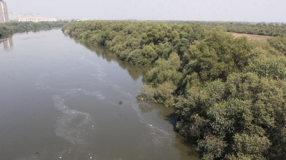
Beyond Kalyan the river, nearly flowing at sea level, merges with the creek waters and it forms the estuary and its flow is totally influenced by the tide and the biggest mangrove forest around Thane and also in the western cost of Diva-Dombivali. In rainy season and during low tide the river continues to flow till Thane where splits into two branches which flow west and south, respectively, around Salsette Island, on which lies the metropolis of Mumbai. The main branch turns northwestward to Ghodbunder, where it opens into the estuary of Vasai Creek. Thane Creek flows south to empty into Bombay Harbour. The estuary of the Ulhas is the site of the historical ports of Kalyan, Kopri and Sopara


The main pollution of these river occur in the estuary part of this river especially beyond Kalyan. This is the area where it forms Mangrove forest. Estuaries and their surrounding wetlands are bodies of water usually found where rivers meet the sea. Estuaries are home to unique plant and animal communities that have adapted to brackish water—a mixture of fresh water draining from the land and salty seawater. Here also we see a large number of species of animals and pants living wet ecosystem. 

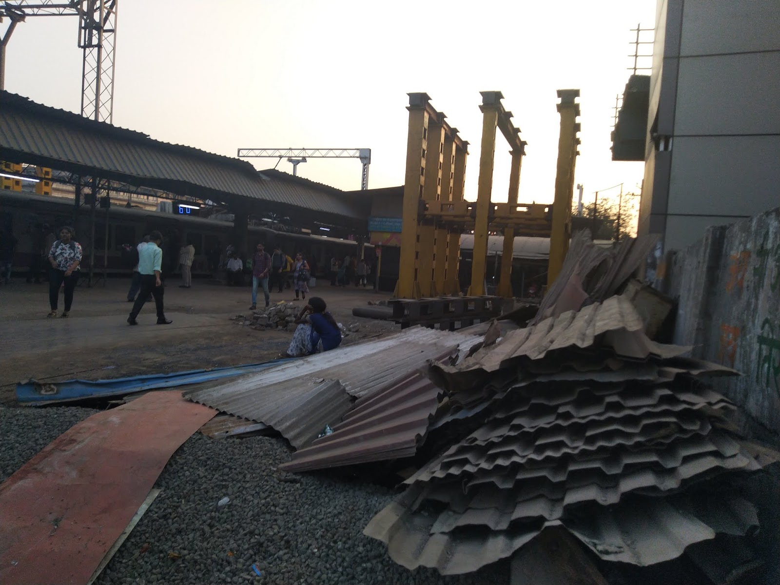
Unfortunately for the Ulhas river it flows through the urban conglomerations of Bhivpuri, Neral, Badlapur, Ambernath, Ulhasnagar, Shahad, Kalyan and Dombivlito become the sewage drain. 


A quality analysis conducted by the Thane district public health laboratory has revealed that water from Waldhuni and Ulhas rivers is highly polluted and unfit for drinking. The findings of the study come less than a week after the Supreme Court (SC) slammed the state for failing to reduce pollution levels in both rivers. 


Indiscriminate urbanization under real estate mafia and land mafia is adding to the woes of this river. Maharastra pollution control board and other civic authorities totally agree that the water of Ulhas is not potable with all the harmful chemicals and other microorganisms. 

 In addition to the dumping of urban waste and sewage is polluting the river completely.  The report also added that the water has a “reddish brown appearance and objectionable odour”. Is this river fit enough supply drinking water to more than 30 lakh residents in Ulhasnagar, Thane, Kalyan, Badlapur and Dombivli??? Percentage of the 126 million litres a day (MLD) sewage generated daily that is treated by the Kalyan - Dombivli Municipal Corporation (KDMC) before it is released into the river. Up from 10% in 2016. This is due to untreated domestic and industrial effluent from Kalyan-Dombivli, Ambernath, Ulhasnagar, and Kulgaon-Badlapur that heavily pollutes the river as it makes it final stretch of journey. Kalyan-Dombivli Municipal Corporation (KDMC) informs the Supreme Court that it is augmenting its sewage treatment facilities by adding five sewage treatment plants (STP) to its current three. The court was hearing a petition filed by an environmental group.


Ulhas estuary forms freshwater ecosystems that have many similar characteristics to the traditional brackish estuaries. For example, along the Great Lakes, river water with very different chemical and physical characteristics mixes with lake water in coastal wetlands that are affected by tides and storms just like estuaries along the oceanic coasts. So it provide many of the ecosystem services and functions that brackish estuaries do, such as serving as natural filters for runoff and providing nursery grounds for many species of birds, fish, and other animals. Estuaries also forms  the most productive ecosystems as many animals rely on estuaries for food, places to breed, and migration stopovers.


The real estate mafia, the sand mafia etc. are becoming a grave threat to the mangroves and it is another urgency to protect Ulhas mangroves with its millions of birds, animals and fishes from becoming extinct completely and we too with it.


Bypass road between NH4 ,NH8 & NH3 through the queen of suburbs of Mum...

Sunday, February 2, 2020

DOMBIVLI - Unique township

Dombivli Station (oldest)


Dombivli Railway Station was established in the 1st May 1887. 
There was only one tall cabin, which was used for ticketing as well as signaling.
 Initially the Railway Tickets to Dombivli” was stamped as “Dimali”. 
Efforts were also made to rename it as “Subhash Nagar” even though
Dombivili has a road named in the name of great freedom fighter.

It has today developed into a Municipal Corporation in the close proximity 
of Mumbai city and Thane city and the availability of local train services 
from the place has given it the position of an important suburb of Mumbai. 

Many of those employed in Mumbai find their residence in Dombivli. 
It is evident from the fact that its population which was 8,106 as per the 1951 
Census rose to 18,407 as per the 1961 Census and further to 51,108 as per 
the 1971 Census and further to —- in 2001.Many co-operative housing societies
 have sprung up in the town where house-building activity is seen in full swing.


Kopar station - Elevated (Vasai to Panvel line) 

        Dombivili has the distinction of two more railway lines 

        1. Kopar station elevated -  Vasai to Panvel line
         

          All trains to North Indian trains pass through this line and in addition
            to this local service between Vasai to Panvel also pass through Kopar

      
Kopar Station on Central railway line 


         2. Kopar station 
            
            Trains of Central railway pass through this line.


           This railway line has uniqueness of connection between Harbor line (panvel) 
            to Central Railway (Dombivili & Kopar) to Western Railway (vasai) 


The Peaceful township in 2001 has today flourished into  Kalyan-Dombivli is a Municipal Corporation city in district of Thane, Maharashtra. The Kalyan-Dombivli city is divided into 107 wards for which elections are held every 5 years. The Kalyan-Dombivli Municipal Corporation has population of 1,247,327 of which 649,626 are males while 597,701 are females as per report released by Census India 2011.

Population of Children with age of 0-6 is 121122 which is 9.71 % of total population of Kalyan-Dombivli (M Corp). In Kalyan-Dombivli Municipal Corporation, Female Sex Ratio is of 920 against state average of 929. Moreover Child Sex Ratio in Kalyan-Dombivli is around 902 compared to Maharashtra state average of 894. Literacy rate of Kalyan-Dombivli city is 91.37 % higher than state average of 82.34 %. In Kalyan-Dombivli, Male literacy is around 93.73 % while female literacy rate is 88.81 %.

Kalyan-Dombivli Municipal Corporation has total administration over 302,735 houses to which it supplies basic amenities like water and sewerage. It is also authorize to build roads within Municipal Corporation limits and impose taxes on properties coming under its jurisdiction.


A big industrial complex has been developed around Dombivli by the Maharashtra Industrial Development Corporation (MIDC).

Dombivli is located about 30 Kms away from the financial capital, Mumbai (Bombay) in the Western state of Maharashtra. in Thane, district and together with another very ancient city of Kalyan just 6 Sq. Kms away forms one of the biggest stat elite township of Mumbai. It has been enjoying a population boom with over 800,000 people (Acc. to 1991 census), and today has developed into a “Concrete Jungle” with greenery of Mangroves.

Initially it was Old Dombivli came into being as the Gajabandhan Village and the West flank is embraced by the river Ulhas forming a part of the Thane creek. Paddy fields on the banks of Ulhas river became vibrant with cultivation during the monsoon and even today many woman in the villages of Dombivli still cultivate vegetables which are called grarachi bhaji (home grown vegetables) are available to buy in Dombivili even though in many areas Paddy fields have been replaced by real estate. . in these areas.

Dombivli boasts a cosmopolitian population with Maharashtrians, Jains, Gujarathis, Kannadigas, Tamilians, Malayalee’s Goans and Punjabis … and a marginal population of Khojas (The Aga-Khan cult) too. Although there are some indications of the town for about 6 to 7 centuries, Not much is really known… Apart from a Huge open space which the Archealogical Survey of India declared as a Pond used by the Peshwa’s and the land adjacent to it happened to be a Horse Grazing and training site. A Huge Stone was un-earthed by the Archaeological Dept. with the inscriptions marking the evidence of the same.

The East part has Municipal Corporation (KDMC) which has not yet made up its mind for development. Plush colonies in the extension area of the town, Which has been under the jurisdiction of the Industrial Corporation (M.I.D.C), has been a real mother of all plans for the Municipal corporation.Today, Dombivli is well known for rapid Industrial growth with major Dye’s, Paints, Chemical and Heavy Metal Factories based in the Industrial Part of the town. Some of the well known of them are Gharda Chemicals, Vicco Labs, Llyod Steel, Deepak Fertilizers, et al. 80’s saw Dombivli growing into a crowded and saturated city due to Industrial development under the plan, which proved advantageous. Dombivli’s approachability by road, rail and huge potential in land and manpower increased tremendously. The industries have been developed in two phases so far and new plans have been proposed.


Saturday, February 1, 2020

Dombivli - Kalyan getting far connected soon

Development of Dombivli -  Kalyan Muncipal corporation 


Dombivli - the queen of suburbs of Mumbai


The Authority is implementing the Mumbai Urban Infrastructure Project (MUIP) in the jurisdiction of Municipal Corporation of Greater Mumbai. Lakhs of people travel to Mumbai from its Metropolitan Region and to make available similar infrastructure facilities for them the Authority thought it necessary to extend the Mumbai Urban Infrastructure Project (MUIP) to the Metropolitan Region and reduce traffic congestion.
The availability of infrastructure facilities will help prosper industries and create newer opportunities in the Metropolitan Region so as to reduce the additional pressure on the infrastructure in the city of Mumbai. The Authority in its meeting held on 24th December, 2007 sanctioned road development and flyover at a cost of Rs.1,493.26 crores in Thane, Navi Mumbai, Kalyan-Dombivali, Mira-Bhayendar, Panvel, Vasai and Virar. This will connect Dombivli to NH4 and NH# and NH8 so that Dombivli - Kalyan will get connected to all over to South India and North India directly. 
The Extended Mumbai Urban Infrastructure Project includes:
  • Construction of 3 creek bridges
  • 2 rail over bridge
  • 9 flyovers
  • Widening and development of 131.50 km long roads

Metro connection - free way between Dombivli - Mumbai - Mira Bhayander


Beautification Possible along Ulhas River - the mangroves


Dombivili - Kalyan is blessed with the mangrove forest and if tendered properly it can become the source of oxygen for the congested City. It is very important that these Mangroves has to be tendered properly. Otherwise it will make the polluted Ulhas creek a dangerous gutter. 
  The International Union for Conservation of Nature says mangrove forests, along with other coastal wetlands like tidal marshes and seagrass meadows, are long-term carbon sinks, storing carbon in the plants themselves but more importantly in the soils below for thousands of years. This process is called carbon sequestration and it can help control global warming by reducing carbon dioxide (CO2) levels in the atmosphere, according to scientists.These ecosystems also are important in coastal protection, habitat, food security, biodiversity and tourism. The world is losing coastal wetlands on a large scale.
Studies have shown that the city is losing its mangrove forests. A study by Godrej & Boyce estimated that private mangrove forests in their industrial estate in Vikhroli absorbed 50,000 tonnes of CO2 annually. It found that mangroves and the soil they are rooted in have absorbed thousands of tonnes of CO2 from Mumbai’s air, effectively cleaning the air of emissions released by vehicles, industries and unsafe burning of wastes. The study showed that mangrove cover in this area has increased, leading to an increase in biodiversity.
An earlier study by the Thane-based BN Bandodkar College of Science found that mangroves along the Thane creek store 2,38,417 tonnes of carbon. To study the carbon content, researchers collected fresh and fallen mangrove leaves from creek sides in Bhandup and Airoli. A study called ‘Carbon footprints of 13,000 cities’ in 2017 estimated that the Mumbai Metropolitan Region, which has a population of over 20 million, released 32 million tons of CO2 annually, with a per capita emission of 1.5 tonnes. Mumbai’s per capita CO2 emissions are low compared to New York’s 17.1 tonnes and London’ 10.4 tonnes, but as vehicle ownership increases and electricity consumption rises, the city’s greenhouse gas emissions will go up.
Mumbai has overlooked and abused its mangrove forests and before environmental laws became more stringent, destroyed large tracts for land reclamation projects, slums and dumping sites. Landsat images from 1988 and 2017 show the destruction of mangroves along Thane creek, with the expansion of the Deonar garbage dump and new construction. The Forest Survey of India estimates that Thane creek still has more than 59 sq km of mangroves.
The real estate business if goes unchecked can do the biggest menace. The area is under great threat because of the soil being collected from the creek. There is the mafias in operation and it is time check these mafias. It is in operation in chawls construction or soil collection. Another biggest threat is the pollution by garbage and sewage. All these needs urgent attention from the authorities.

There is a debate about the health of city's mangrove forests. Some environmental groups have said that about 70% of  mangroves have been destroyed due to various development activities, but satellite imagery, which has recorded decline in mangrove forests in many areas, have also reported another development. Sedimentation is narrowing Mumbai’s waterways, including the Thane creek. The new mudflats created by the sediments are being colonised by mangroves, thus expanding the green cover in certain areas.


Thursday, April 6, 2017

Kalyan the commercial centre


Dombivli - Kalyan is the fastest developing Satellite township in the vicinity of Mumbai city


The Congested Mumbai do not have any other option but turn to  Lust green landscape of Mumbai


People are thronging to this city and today is the fastest growing township in Maharashtra.